Sonoran Desert Corridor™ market area
A consistent approach to North Phoenix real estate market reports.
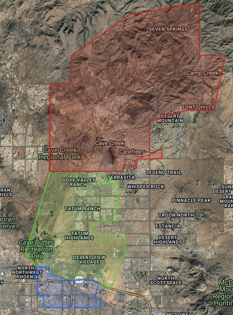
Sonoran Desert Corridor™ market areas map showing Up the Creek™, Down the Creek™, and 51 Corridor™.
Sonoran Desert Corridor™ Market Area Methodology
This page explains the Sonoran Desert Corridor™ market areas used in my North Phoenix real estate reports. Instead of reporting statistics for the entire Phoenix metro area, I focus on the neighborhoods I know best. This provides buyers and sellers with market information that is more relevant to the homes they are most likely to compare.
For consistency, I divide my coverage area into three distinct market areas: Up the Creek™, Down the Creek™, and the 51 Corridor™.
The terms Up the Creek™, Down the Creek™, and 51 Corridor™ are market area designations created by Wayne Metcalf to describe the geographic areas covered by his market reports. These market areas are unique to my market reports and are designed to provide consistent neighborhood comparisons over time.
In addition each section includes an interactive map showing the exact boundaries.
Up the Creek™
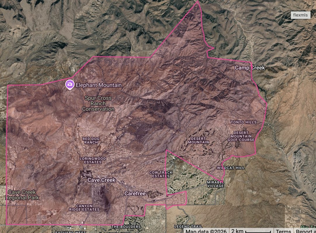
Up the Creek™ includes properties located within the incorporated town limits of Cave Creek and Carefree that lie north of Carefree Highway.
The only exception is the small southeastern portion of the Town of Cave Creek, as defined by ARMLS. Although it remains within the incorporated town limits, it lies south of Carefree Highway, generally between Dove Valley Road, Black Mountain Parkway, and 56th Street. For consistency, I include this area in Down the Creek™ because Carefree Highway serves as a natural boundary and doing so it aligns more closely with the surrounding neighborhoods.
View the Up the Creek™ boundary map.
Down the Creek™
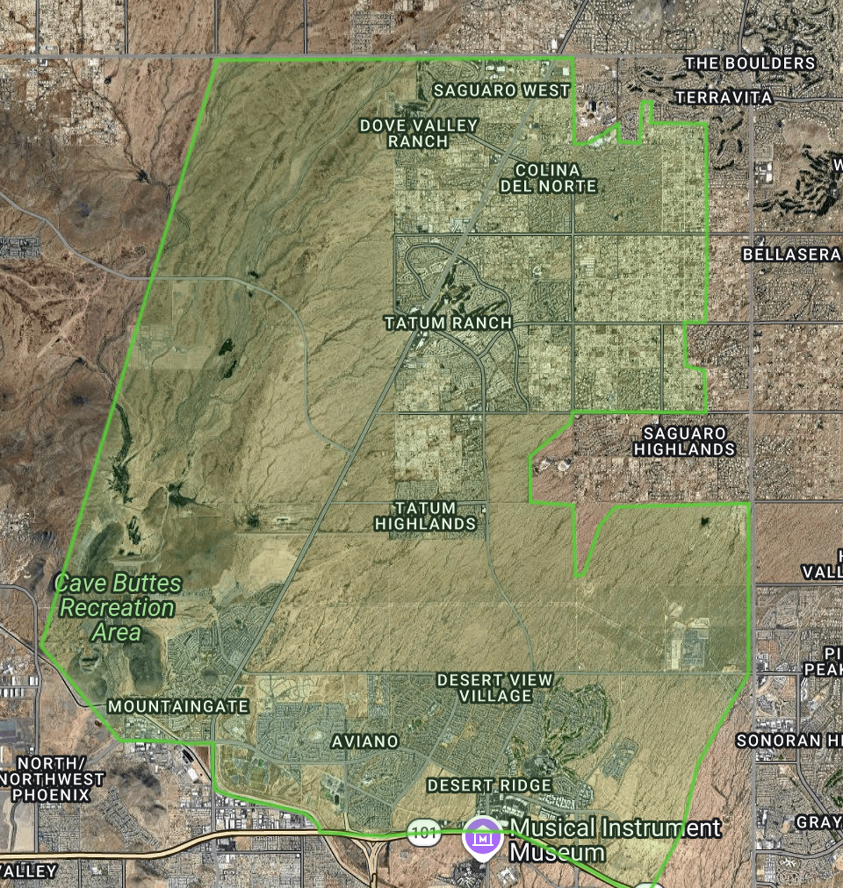
Down the Creek™ includes the Cave Creek Road corridor south of Carefree Highway, including the southeastern Cave Creek pocket described above. It also encompasses nearby North Phoenix neighborhoods that share similar housing styles, price ranges, and buyer demand. Many of these communities have Cave Creek mailing addresses even though they are outside the incorporated town limits.
View the Down the Creek™ boundary map.
51 Corridor™
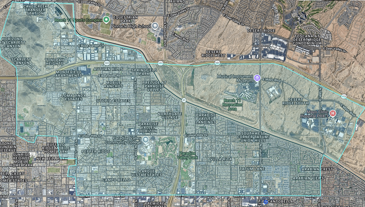
The 51 Corridor™ includes neighborhoods generally located along the State Route 51 corridor in North Phoenix. I group these communities because they share similar commuting patterns, amenities, housing characteristics, and market activity.
View the 51 Corridor™ boundary map.
Property Types Included
To maintain meaningful comparisons, my reports primarily analyze resale single-family homes.
I generally exclude the following property types:
- New construction
- Manufactured or mobile homes on leased land
- Duplexes and other multi-family properties
- Most lower-priced condominiums and townhomes
The following geographic areas are also generally excluded:
- Scottsdale mailing addresses
- The Boulders and the custom-home communities north of The Boulders
- Desert Hills west of Cave Creek Road
Sonoran Desert Corridor™: Why These Boundaries?
However municipal boundaries do not always reflect how buyers shop for homes, real estate markets rarely follow city limits or ZIP codes.
Buyers often compare homes that offer similar locations, amenities, price ranges, and lifestyles, regardless of municipal boundaries. As a result, these reports provide more meaningful comparisons.Therefore I developed these market areas to reflect the neighborhoods buyers naturally compare.
I compile market statistics using data from ARMLS and other reliable sources.